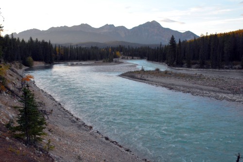
wildlyrandom

Our camping trip in British Columbia, Canada, including a drop down to Yellowstone National Park.

Category: moments in time

river float

[19th September]

Our sleeping bags were so toasty but the sounds of the dawn were coaxing us out into the chilly morning; there was that viewing platform after all and we might be missing out. We envied those already there holding steaming cups of coffee, but there was no going back now as they excitedly pointed out the bear. Sure enough, there in the distance, our binoculars zoomed the tiny black speck into a full-sized brown bear waddling along in our direction.  But first, he waded into the icy blue waters to catch himself a fish which he savoured right there in the middle of the river before emerging again and continuing in our direction. He disappeared into the thicket but re-emerged just as we turned back to put that pot on to boil. If those holding their steaming cups had not called us back, we would have missed a sighting, so close, we could hardly believe our good fortune.
We heard later that this was a rare sighting. Little did we know at the time just how lucky we were!

0023u

Is it a brown bear or a grizzly? The answer is that all grizzlies are brown bears, but not all brown bears are grizzlies. The grizzly is a North American subspecies of brown bear with the Latin name Ursus arctos horribilis. The correct scientific name for a grizzly is “brown bear,” but only coastal bears in Alaska and Canada are generally referred to as such, while inland and Arctic bears and those found in the lower 48 States are called grizzly bears.
~ taken from http://www.pbs.org/wnet/nature/bears-of-the-last-frontier-brown-bear-fact-sheet/6522/

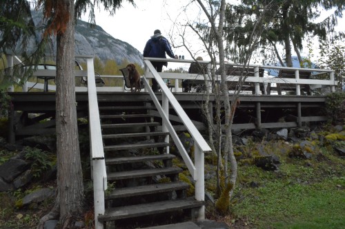
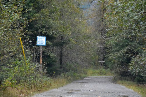
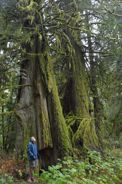
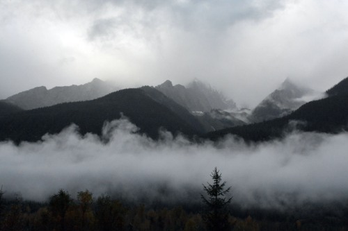
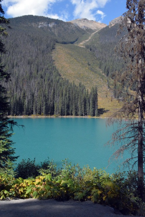
We had a bit of time to kill before meeting the rest of the group for our float down the river, so we dropped in at Snootli Regional Park for a short ramble through the forest. It was magical for us, coming from a dry country; a fairy tale coming to life, our very first taste of trees stretching to the heavens, dripping in moss.

The Big Cedars Trail in the park is home to an ancient cedar grove. The First Nations people used this area, for which respect needs to be shown, to harvest bark and wood from these sacred trees. The scars left, after planks were cut away from the living tree, are clearly visible here.

0024a0024b

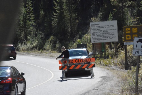
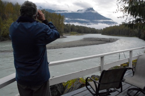
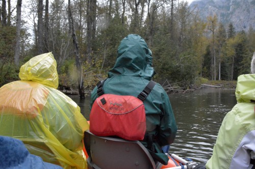
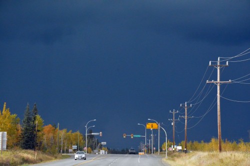
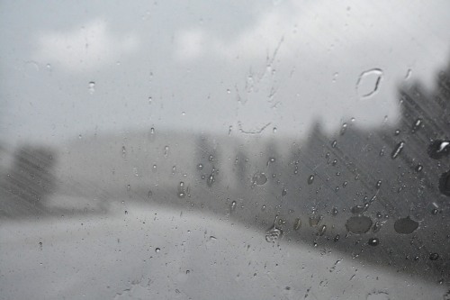
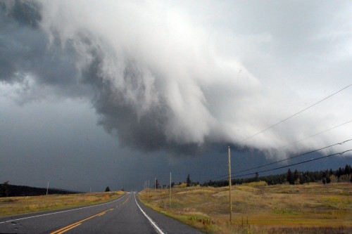
The weather is not that of a sunny South Africa; in fact we are not even sure if our float down the river will go ahead… but we are not disappointed, rain most definitely does not deter a single thing down here.
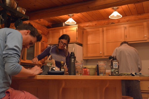
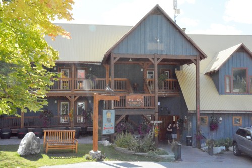
This is a gift from my daughter and her husband for my birthday and I am beside myself with excitement! We have a booking with Kynoch Adventure Tours and arrive at the Bella Coola Mountain Lodge 15min prior to departure, to sign the waivers.

While we wait for our guide, we step out into a brief splash of sunshine to meet the other two couples joining us on the float. They are Canadians from Calgary and they are on a road trip across British Columbia.
Time to pile into the van. En route to the boat launch, our guide stops to point out a strange sight among the cattle, but it is nowhere to be seen… another time maybe.
Life jackets on, rules of the river explained, we take our seats and push out into the adventure, not without trepidation… we are hoping to bump into bears, brown bears and black bears!

0025

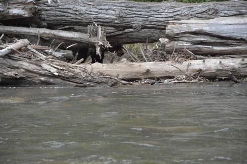
Up ahead there is a platform on which lenses of extraordinary lengths are propped up on tripods… waiting. Apparently, they can wait in vain for days.

But not today.

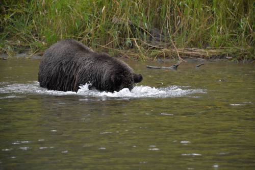
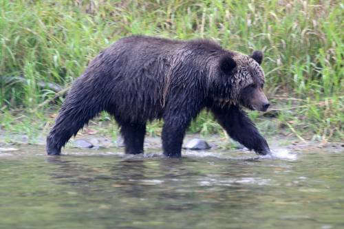
We are still heading out into the river when suddenly our guide leaps out of the rubber ducky and drags the boat back. Out of the corner of his eye, he has spotted movement, and there before our very eyes, just a hop away, a brown bear emerges looking altogether just like a giant teddy bear.

What a rush!

0025dlook at those claws!0025f

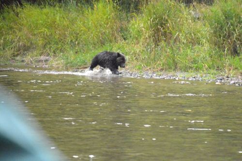
We have the back seats so I notice when our guide looks back suddenly – he had noticed, he says, that our brown bear had spotted something behind us, and sure enough, a black bear had come down to drink. Sadly though, in a flash, he dashed back for cover. Black bears are shy and do not hang around brown bears. I was very lucky to have spotted that one too.

Black Bears vs Grizzly Bears ~ taken from Bear Smart

Black bears can be black, blue-black, dark brown, brown, cinnamon and even white. Grizzlies, likewise, may range in colour, from black to blond. Although grizzly bears are, on average, significantly larger than black bears, size is not a good indicator of which species is which.

The best indicators are the size of the shoulders, the profile of the face and the length of the claws. The grizzly bear has a pronounced shoulder hump, which the black bear lacks. It also has a concave or “dished” facial profile, smaller ears and much larger claws than the black bear. Black bears have a flatter, “Roman-nose” profile, larger ears, no visible shoulder hump and smaller claws.

See also

https://www.pc.gc.ca/en/pn-np/mtn/ours-bears/generaux-basics

and

https://www.nps.gov/articles/bear-identification.htm

for more detail.

When our very knowledgeable guide, who has been in the family business forever, decides to leave our brown bear in peace, we float on down. The cameras cheer and show thumbs up.

The waters ripple with salmon; the edges littered with those that have spawned and died.  Even though it proves to be quite a slippery affair to land a fresh bite, only once the run has come to an end, will the bears settle for rotting flesh.

It rains softly off and on; the nooks and crannies that usually yield bears are dismally quiet… we console ourselves with the thought that we could easily have seen nothing at all on this trip… when all of a sudden, there they are, mother and baby, frolicking with fish. Bears are solitary (this I did not know) and one only really sees groups, small groups at that, when a mother with her one or two (rarely 3) babies, passes by.

0025hwait for meeeee...0025igot him!

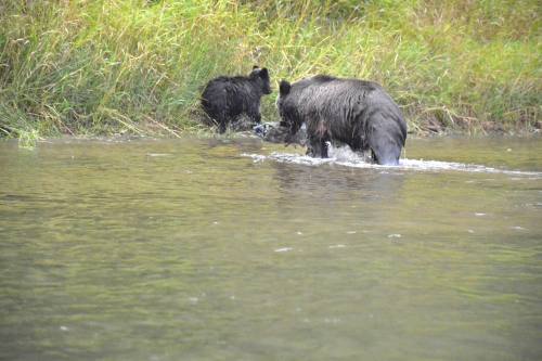
They disappear into the long grass to enjoy lunch.

WHAT a treat!! Thank you for a very, very special birthday present!


Next day: a cow… or is it?
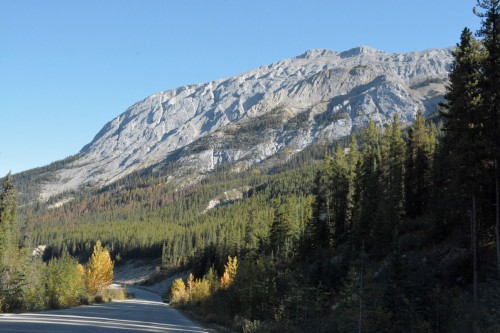
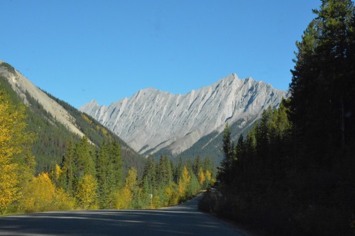
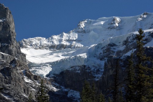
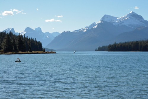
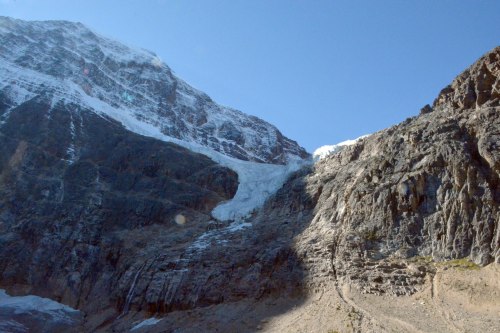
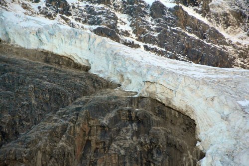
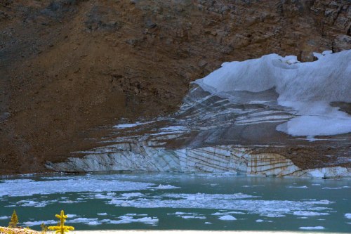
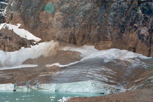
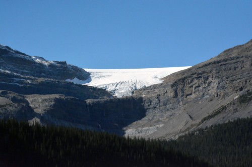
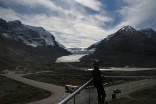
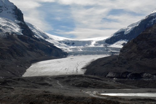
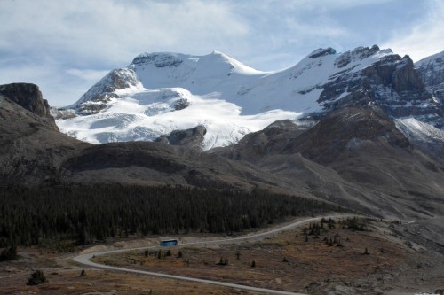
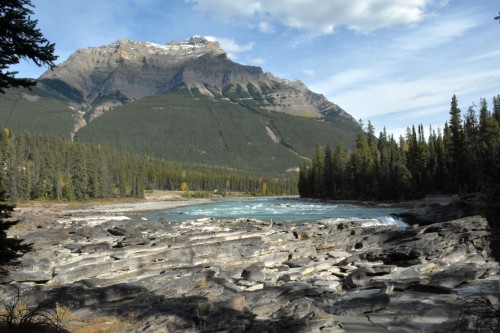
 

dropping into the valley

[18th September]

We head out due west on a softly misty morning. Highway 20, the only road access to the Great Bear Rainforest, rambles through the Chilcotin Plateau. The road passes through several small communities, at one of which we bump into a morning market where we treat ourselves to some local fare. Dodging livestock, we drive on at a leisurely pace; we are heading for the Bella Coola Valley where a very special float down the Bella Coola River awaits our arrival.

00230023a

0029d

0023b

yummy bannock and jam

0023c

I wonder whether I would have agreed to head into the Bella Coola Valley if I had read the brochure properly. I was NOT expecting the Coast Mountain Range to cross our path, and especially not the pass! I have no photos to show at this point, as I needed both hands to hold very firmly on to my seat (I am a little braver when we drive out of the valley again).

FINALLY we reach terra firma. Relaxed now, I enjoy the drive on the 80km valley floor through Tweedsmuir Park and on to our lovingly tended campsite in Hagensborg. Hagensborg was established by Norwegian colonists who settled in the valley between 1894 and 1910.

0023d

Rip Rap Campsite

The Bella Coola River is a mere scramble over the rocks to the right, the tenting site to the left.

0023k0023l0023m0023n0023o0023p

Next day: our first encounter with a bear

going west

[17th September]

And then the rain came down. Our aim on this day was to reach a point halfway to the west coast. We would travel due west on Highway 1 through Kamloops, turning north onto Route 97 at Cache Creek and then on to William’s Lake where we would spend the night.

We came upon the strangest tunnels en route; tunnels in our experience afterall, are there to pass through mountains, but these tunnels were not passing through anything. We eventually realised that they were most probably avalanche tunnels, difficult as it was to imagine these slopes covered in snow, given the fact that snow is not something commonly seen where we come from.

0022a0022c0022d


Nothing quite like a hot cuppa on a rainy day! And in a strange country, anything familiar becomes a welcome sight; Tim Hortons became that for us, and only because while traveling with our children we had stopped at one (or two) for refreshments.

There were two things on this trip for which we were very grateful; 100km speed limit (it is 120km in our country) and no sign of an early winter as we did not have winter tyres (we had only 2 weeks in hand before winter tyres became compulsory).

And then, our tummies started to grumble. We had secured a whole roasted chicken and salads for lunch (not the first time either) and it was now time to find a suitable spot to pull off and dig in.


Route 97 north of Cache Creek came with town names that compelled me to hit google:

“The South Cariboo historic roots go back to the fur trading days before the gold strike. By 1860, thousands of gold seekers thronged to the Cariboo to seek the precious metal. Between 1862 and 1870, over 100,000 people traveled the Cariboo Wagon Road from Lillooet, making their way north into Cariboo country.

Throughout this gold fever, certain roadhouses, because of their favourable locations along the Cariboo Wagon Road from Lillooet to Soda Creek, grew to be supply points for the gold seekers and the surrounding district. 100 Mile House, South Cariboo’s dominant community, was originally one of these stopping points along the gold rush trail. 100 Mile House was so named because it was located 100 Miles from Lillooet (Mile 0) of the Cariboo Wagon Road. As the gold rush subsided, ranchers began to settle the surrounding area.

Today, the South Cariboo consists of a number of small unincorporated communities in the outlying area surrounding the District of 100 Mile House and has a population greater than 20,000.”
~ taken from http://www.100milehouse.com/

0022k0022l0022m

“Other roadhouses of note in the area include 59 Mile House; built overlooking Painted Chasm it included a fifty stall barn to accommodate the horses of Barnard’s Express Company. A roadhouse was constructed at 70 Mile. Incredibly, this house operated continually from 1862 to 1956 when it was consumed by fire.

The 105 Mile House was unlike most of the Cariboo roadhouses in that it was a handsome building built in a Victorian style. This house was moved from its original location and now resides at the 108 Heritage site where it can be toured by the public.

108 Mile House started as a somewhat cruder affair in 1867. It was only eight miles from 100 Mile House so stage coaches probably passed it by, although it would have been a welcome site to those walking pack animals. By 1875, although there was no evidence of ownership, it was known as the 108 Mile Hotel and was run by one Agnus McVee and her husband Jim.

The next owner tore down the building and reassembled it at what is now the 108 Heritage site. Several more buildings such as a blacksmith shop and an ice house were added, the most notable being the Clydesdale barn built in 1908. This is the largest log barn of its kind in Canada and is still standing at its picturesque location on the shores of 108 Mile Lake.

The builders of the 111 Mile House felt they had a good location and built a large and impressive, two-story inn. They were right because four horse stagecoaches from Barnard’s Express made it a regular stop as a horse change station. It operated till 1909, sat empty for awhile and finally became part of the 3000 acre Highland Ranch. Today only one small building remains beside the creek.

The 118 Mile House is not as old as some but the building still stands on private property visible from highway 97.

The roadhouse at 127 Mile started as a blue army tent. It operated as a bar while a building was erected. It was a large, attractive two story building but the location was popularly known as the Blue Tent Ranch for many years. In 1904, it went the way of many buildings in an era of woodstoves and no fire departments, it burned to the ground.”
~ taken from http://www.100milehouse.ca/history/index.html

The clouds grew more and more menacing! It was not long before huge drops obliterated the road – we prayed that hail was not about to destroy our children’s trusty steed!

And of course, we wondered just how we were going to manage to set up camp in the deluge! It was decided that a motel of sorts in William’s Lake might be a jolly good idea, but price rates soon put paid to that idea, at which point, exactly, the sun came out!

0022n0022o

William’s Lake had a campground and William’s Lake was an excellent halfway stopover; what we had not realised was that the campground was part of the Home of the Famous William’s Lake Stampede.
We arrived, along with many other folk – there was clearly a function on that night – and confused again as to where to go, wandered into the function area to look for a place to book in for the night. No such place there, so we headed off around the arena to where we had spotted camper vans. There still was no office or anyone at the gate, but we soon discovered the very efficient (yet again) self-registration procedure.
There was a very soft stretch of very green lawn at the opposite end of the campground which was allocated to tenting (with a very clear sign asking us not to park on the grass, which we had not noticed! Apologies to those concerned!) We set up camp, enjoyed our supper under the most spectacular sunset and retired for the night, just nicely settled in when announcements could be heard over the loudspeakers at the function; announcements that never seemed to end… but wait, those are not announcements, they are holding an auction, a fund-raising auction to be sure.
And then the entertainment began; we were lulled to sleep by the most delightful foot tapping Canadian country music, a treat indeed!

0022p0022q0022r

Next stop: BEARS!

truffle pigs

[September 16th]

We were still firmly snuggled down in our far too airy little tent when the bustling of campers started up well before dawn. It is a strange feeling lying there wondering who is doing what and how close; invariably our imaginings turn out to be quite off target too.
Finally, we did emerge to find the place all but evacuated… that is when we sprang into action to choose ourselves a better site. Claimed and paid for, we set up camp again. The river gurgled past close by; we felt cozy, nestled now amongst the trees.

Today is the day we set out to find Emerald Lake that comes as a ‘don’t miss’ recommendation wherever one looks.
But first, another must stop en route to the lake, the Natural Bridge created by the strong torrents of the Kicking Horse River that undercut through solid rock.

0021a

0021c
0021d

Water flows through time and wears down mountains.
In the moment of our lifetime, we see but a part of the process.
Yesterday’s waterfall is today’s bridge, becoming tomorrow’s chasm.
~ taken from info board on site.

0021f0021g

Emerald Lake is breath-taking! We follow the path away from the crowds to enjoy the quiet tranquility of the emerald waters.

0021h0021i

Avalanche slope – close-up
This avalanche path is a place where snow moves with incredible speed and power.
The plants here are low and flexible enough to bend with the blast of thousands of tons of hurtling snow and straighten slowly up when the snow is gone.
The open avalanche path provides food for animals varying in size from mice to moose; and these animals, in turn, are food for predators who depend on this open space for easier hunting. A keen-eyed hawk in a tree nearby has likely postponed his hunt until you pass beyond his territory.
~ taken from info board on site.

0021j

Time for that lunch. Today we eat out at The Truffle Pigs in the little town of Field which is situated within Yoho National Park.
“At Truffle Pigs we believe in fresh local and regional ingredients, and non-medicated meats. We believe the mealtime experience should be social and energetic, and that children have a place at the table. And we believe that neither cooking nor eating should be rushed, because quality food and quality time go hand in hand.”
~taken from The Truffle Pigs Bistro
It was the ‘fresh local’ and the taste combinations on the menu that sold it to me; the bistro lived up to its recommendation with flying colours and flying pigs (even though for us the exchange rate made the meal a luxury we could not repeat, sadly).

0021b

0021k0021l

The day was not yet done…

Takakkaw Falls

The 13km scenic drive to the falls is a treat on its own. It comes with a couple of switchbacks, my first experience of such. I never did get the instructions for the reverse maneuver for longer vehicles, but longer vehicle or not, the bends could not be taken at the same time as another vehicle, which was a little hair-raising if you were puffing up to the turn while someone else was in the turn… unless, of course, you are a pro at stopping and starting on steep inclines.

When you say Takakkaw, you are saying it is ‘magnificent’ in Cree which is spot on for this 254m waterfall, one of the highest in Canada.
Daly Glacier, 350m from the brink, feeds the falls. The glacier, in turn, is fed by the Waputik Icefield, snow falling on the icefield becomes moving ice in the glacier, which melts to become Takakkaw Falls.
In summer, the rock face roars with the plunging mountain torrent. But in the autumn, the melt is slowed, and by winter, the racing falls narrows to a ribbon of ice awaiting summer to set it free.
~ taken from an info board on site.

0021q0021p0021n2

Back at the camp, there was just enough daylight left to do the first bit of the very interesting 1.2km (one-way) self-guided trail following in the footsteps of the rail workers back in 1884:

A Walk in the Past

A walk up this trail is your ticket to the past. Over a century ago men struggled to build a railroad down the steep Kicking Horse Pass. Today you can follow their old tote road, touch the soot left behind by long-gone steam locomotives and discover an abandoned work engine.

Take the trail guide along and allow about 2 hours for the return trip.

Caution: The trail crosses a main line of the Canadian pacific Rail which is used many times a day, so watch out for trains!

~ taken off the info board.

0021r2

Satisfied after a good day, we pile up on wood… we are ravenous!

0021s

Yoho has most certainly lived up to its name which means ‘awe’ in Cree. Perhaps I was guided by intuition to miss that extra night up in Jasper…

Tomorrow we head out across the plains of BC to reach the west coast of Canada…


dates gone awry

[September 15th]

Time to rise and shine, roll up our mattresses and head out into the northern reaches of Jasper National Park.
The drive to Maligne Lake, and especially the boat trip out onto the lake, was strongly recommended by our neighbouring campers back in Johnston Canyon Campground, but we have a long road ahead back down the Icefields Parkway to Yoho National Park, so time is not on our side. The boat trip will have to take a miss.

The town of Jasper welcomes us. We sail on by, turning down, not long after, to follow the Maligne River to the lake.

0020f1

Where there is a gathering of cameras there must be something to see; sure enough, there he is, lounging in the long grass. The sun has barely seen the light of day; there is time a-plenty for grazing yet.

0020a0020d10020d2

It is a beautiful 48km drive down to Maligne Lake from Jasper. About half way down we pass the most peculiar Medicine Lake, a lake with a river inflow, but no river outflow.

“Like drains in a giant bathtub, gravel-strewn openings in the floor of Medicine Lake allow its waters to escape underground. In summer, the sinks are under nearly 20m of water, while during the winter they lie at the bottom of small frozen ponds in the otherwise empty basin – rather humble beginnings for one of the greatest underground rivers in the world.” ~ taken off an information board on site

0020eMedicine Lake

Maligne Lake… and we have been warned! Sadly not a moose in sight, however.

0020c1

We watch longingly as the boats chug out and disappear onto the nearly 28kms of water from end to end. Reaching a depth of 96m, this is the largest lake in the Canadian Rockies.

0020b

There is some exploring to do around the lake before we head on out again, back through Jasper, branching off onto Parkway 93A, an alternate route following the old highway just 7km from Jasper. The Mt Edith Cavell road branches off this road and we are especially keen to find Cavell Pond and the Angel Glacier.

0020o10020g0020h0020i10020i20020j

“Angel Glacier forms in a large bowl, or cirque, largely hidden from view. Very slowly, it flows out of the cirque towards you. Some ice breaks over the vertical cliffs, forming the angel’s 40m thick wings; the remainder plunges down a steep gully, forming the body. This constant movement of the glacier sometimes causes an ice avalanche, so it is dangerous to climb beneath this hanging glacier” ~ taken from an info board on site.

0020k10020k20020l0020m10020n

It is time to move on again, bumping into another bunch of cameras, this time treated to our first sighting of fluffy mountain goats.
And then back past spectacular ice blue rivers and the Icefield.

0020p10020p20020q10020q20020q30020q40020q5

It is at about this point that we start to reflect on the days ahead. It is Hugo that first realizes that dates are not tying up… my, by now, very confused head finally figures out that I had somehow neglected to remember that I had allocated 2 nights at Wapita Campground. The silence is deafening. There is no way to describe the feeling of loss, of having missed out on that which we will most probably never see again. There is no going back. I pray that our now two nights at Yoho National Park will compensate.

It doesn’t start off well…

0020q6

The Spiral Tunnels can be found en route to the campground. They did little at the time to lift our spirits (fortunately we spent a good chunk of time there making memories to enjoy later).

Parks Canada does an excellent job of relating the fascinating story of the tunnels:

Spiral Tunnels

Background

When British Columbia joined Confederation in 1871, it was on the condition that Prime Minister John A. Macdonald would build a railway to link the province to the rest of the country. Building a railway across such a large continent was a major undertaking and one of the most serious obstacles was the Rocky Mountains. Several passes were considered for the route and despite its rugged terrain, Kicking Horse Pass was chosen because of its proximity to the US border and its shorter distance to the Pacific Coast. This choice was so significant to the history of Canada that Kicking Horse Pass was designated as a National Historic Site in 1971.

The steep grade in Kicking Horse Pass posed a serious challenge. Under government pressure to complete the railway, and given the engineering challenges that came along with the geography, Canadian Pacific was not in a position to carve a gradual descent. A solution was reached, which temporarily allowed a grade of 4.5%. The first train to attempt the hill in 1884 derailed, tragically killing three workers. In an effort to improve safety, three spur lines were created to divert such runaway trains on what became known as the “Big Hill”. Switches were left set for the spurs and were not reset to the main line until switchmen knew the oncoming train was in control. Descending the Big Hill was challenging, but uphill trains had their problems too. Extra locomotives were needed to push the trains up the hill, causing delays and requiring extra workers. Although the mountains were a complication for CP, they were an inspiration to the many tourists who started to arrive by train. In an effort to preserve the landscape and encourage tourism, CP prompted the creation of Mount Stephen Dominion Reserve in 1886. The park was renamed Yoho in 1901.

Schwitzer’s Solution

The solution for a more gradual grade came from J.E.Schwitzer, one of the railway’s Assistant Chief Engineers. He modeled the Spiral Tunnels after a system used in Switzerland. In 1909 the Spiral Tunnels were completed and after 25 years of use, the Big Hill grade was abandoned. With a gentler grade, descents became safer and slower, spur lines and rear pushers were no longer necessary, and scheduling delays and operating costs were reduced. Although the Spiral Tunnels were a great improvement for the grade, rockfall, mudslides and avalanches are some of the challenges we still face today in this area where nature reigns supreme.

How the Spiral Tunnels Work

An eastbound train leaving Field climbs a moderate hill, goes through two short, straight tunnels on Mt. Stephen, under the Trans-Canada Highway, across the Kicking Horse River and into the Lower Spiral Tunnel in Mt. Ogden [1]. It spirals to the left up inside the mountain for 891-m and emerges 15-m higher [2]. The train then crosses back over the Kicking Horse River [3][see illustrations below for text in bold], under the highway a second time and into the 991-m tunnel in Cathedral Mountain. The train spirals to the right, emerging 17-m higher and continues to the top of Kicking Horse Pass.

See Them for Yourself

There are two viewpoints where you can safely watch trains and learn more about the Spiral Tunnels and Kicking Horse Pass National Historic Site of Canada. On average, 25 to 30 trains pass through the Spiral Tunnels daily, though not on a regular schedule.

~ taken from Parks Canada

0020r
0020r20020r1
the train emerging from the Mt Ogden tunnel

We are lucky enough to bump into a 2nd train as it arrives, in so doing seeing 3 pieces of the same train (up to 1000m long) in 3 different positions.
With the highway at our backs, the train, going east, has crossed under the highway, has crossed the river and [1] is still entering the tunnel [2] it is still emerging from the tunnel 15m higher and [3] is passing right below where we are standing, back towards crossing under the highway.

0020r3

And then…

The campground is full!

And there is only one campground open at this time of the year!
There is, however, still a bare piece of grass available in the overflow area for campervans. It is close to gate closing time. I guess they don’t expect many more campervans; they let us set up camp there.

The setting is spectacular!

0020s
0020t

But first fuel and food…

I have earmarked only one eating place for the whole trip, and it is in the little town of Field in the Yoho National Park… tomorrow…


Thought for the day:

WANTING TO BE RIGHT
“We feel that we have to be right so that we can feel good. We don’t want to be wrong because then we’ll feel bad. But we could be more compassionate toward all these parts of ourselves. The whole right and wrong business closes us down and makes our world smaller. Wanting situations and relationships to be solid, permanent, and graspable obscures the pith of the matter, which is that things are fundamentally groundless.”
(When Things Fall Apart) ) Pema Chodron

Icefields Parkway

[September 14th]

The nagging thought of the possibility of ice on the road (the weather, after all, is not all that predictable of late) has sent adrenaline coursing through my veins for far too long… I have to keep reminding myself time and again, to come back to the present moment!
Finally that nagging moment arrives, and of course, there is ice only way up high…

…mesmerizing glaciers around every corner.

The long anticipated Icefields Parkway.

icefieldsparkwaymap

0019
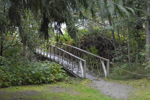
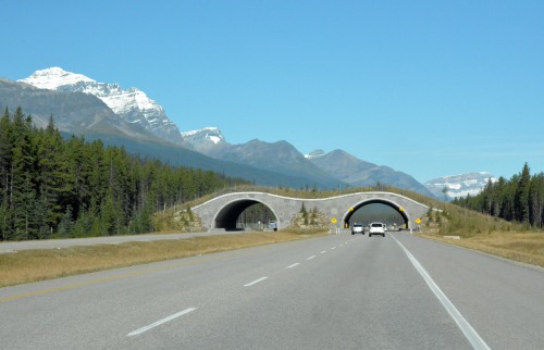
animal bridge of which there were several

0019a
Icefields Parkway, dry as bone

0019b
Crowfoot Glacier

0019eh
Bow Lake [photo by Hugo]
0019d
Bow Glacier0019f0019h

The amble to Peyto Lake took us up a fairly steep path flanked by light snow, passing several very interesting information boards.
What a spectacular sight!
On the return down, I am ashamed to admit, I was attacked by a Ptarmigan; I had spotted him foraging just off the path and could not bring myself to gather up my camera and move on until he decided to help me on my way by storming me. I felt bad for hours afterward for having disturbed him in his very own territory to that extent!

0019i0019i10019j0019j1

Moving on up, the much anticipated Columbia Icefield (and Jasper National Park) looms ahead of us.
We are a little parched by this time so head for coffee before settling down in one of the comfortable chairs provided on the deck of the Icefield Centre, in the howling wind, to soak in the sun and the sights.

0019k0019k10019l0019n0019nh0019o0019p0019q0019r

The Columbia Icefield is a surviving remnant of the thick ice mass that once mantled most of Western Canada’s mountains. Lying on a wide, elevated plateau, it is the largest icefield in the Canadian Rockies.

The Athabasca is the most-visited glacier on the North American continent. Situated across from the Icefield Centre, its ice is in continuous motion, creeping forward at the rate of several centimeters per day. Spilling from the Columbia Icefield over three giant bedrock steps, the glacier flows down the valley like a frozen, slow-moving river. Because of a warming climate, the Athabasca Glacier has been receding or melting for the last 125 years. Losing half its volume and retreating more than 1.5 kms, the shrinking glacier has left a moonscape of rocky moraines in its wake.
~ taken from: http://www.pc.gc.ca/eng/pn-np/ab/jasper/activ/explore-interets/glacier-athabasca.aspx

The RIVERS! That COLOUR! It truly is a wonderland!

0019r1

Next stop, Athabasca Falls:

A powerful, picturesque waterfall, Athabasca Falls is not known so much for the height of the falls (23 meters), as it is known for its force due to the large quantity of water falling into the gorge. Even on a cold morning in the fall, when river levels tend to be at their lowest, copious amounts of water flow over the falls. The river ‘falls’ over a layer of hard quartzite and through the softer limestone below carving the short gorge and a number of potholes. The falls can be safely viewed and photographed from various viewing platforms and walking trails around the falls.
~ taken from: https://en.wikipedia.org/wiki/Athabasca_Falls

0019s0019t0019t10019u0019v

Tourists are a dead giveaway; you see them causing traffic obstructions wherever there is something to be seen… we are most definitely tourists!
Animals with horns like this are only seen in books after all…

0019w0019w10019w2
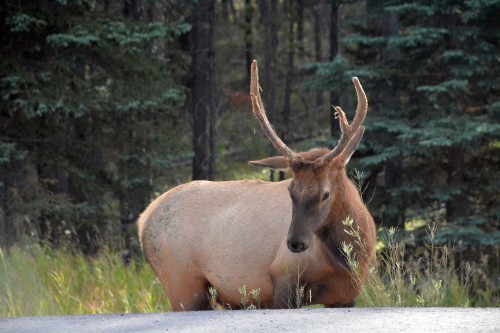
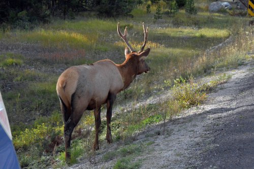
There were no females in sight and we did keep our distance… I’m sure it was 30meters.

The awesome wonder of a day is drawing to a close and we need to find our campsite:
Another cozy spot amongst the tallest of trees.
Another fairytale river running through it.
A watering can with which to do our little bit.

0019x0019x10019x20019y0019z

Sleep comes easily this night.
On the morrow we will have to weather my miscalculation…

Thought for the day from Robert Holden:
It is because the world is so full of suffering,
that your happiness is a gift.
It is because the world is STILL so full of poverty,
that your wealth is a gift.
It is because the world can be so unfriendly,
that your smile is a gift.
It is because the world is so full of war,
that your peace of mind is a gift.
It is because the world is in such despair,
that your hope and optimism is a gift.
It is because the world is so afraid,
that your love is a gift.

~ The Happiness Project Mission Statement

Banff National Park

[September 13th]

We really do need to pinch ourselves on this day as we set out to explore Banff National Park, which, only a few months ago, coming from dusty Africa, seemed like an impossible dream; a place of beauty we could hardly imagine, a place of unimaginable hues in blue and white, mountains looming large and icy conditions.

It did not disappoint.

And so, on the morning of the 13th, after a hearty breakfast, we continued from our campsite along the Bow Valley Parkway which would take us right up to Lake Louise. There was consensus, when exploring the area online, that Lake Louise should not be missed. One really needs to hang around for a very long time to enjoy this area with all it has to offer, but we have only one day, so elimination had to be ruthless.

0018a

0018b1

Breath-taking!

As the lake came into sight, it literally took my breath away!

Photos capture only the minutest fragments of the whole sensation of breath-taking wonder. I would like to just sit down and absorb it all… but try as I may I need to take photos, the compulsion to share is uncontrollable and yet nowhere near even good enough.

0018c0018d0018e
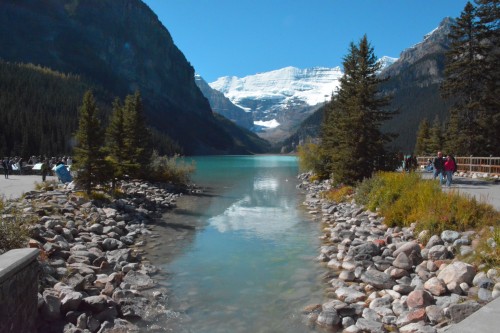
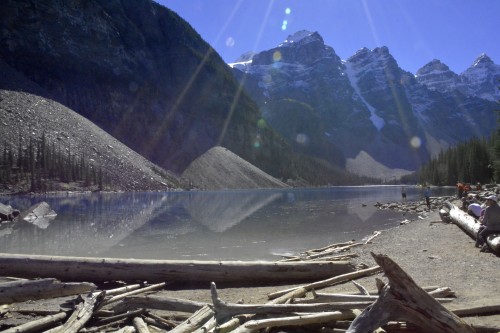
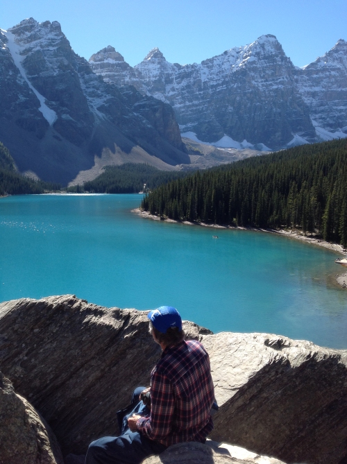
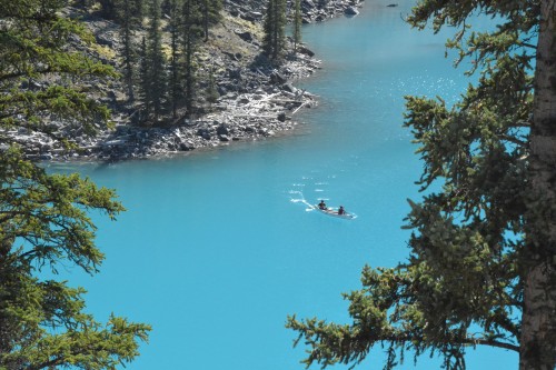
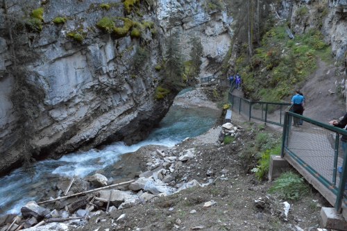
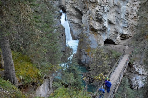
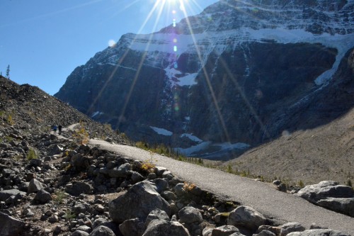
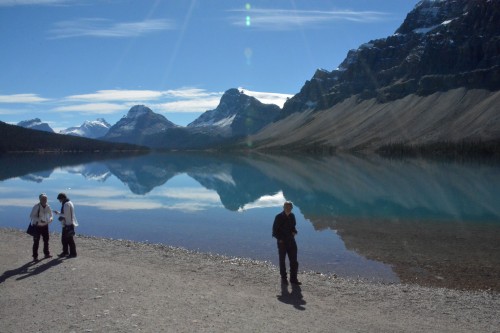
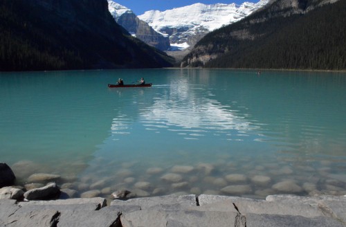
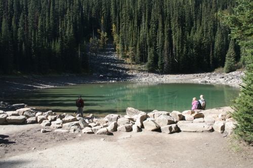
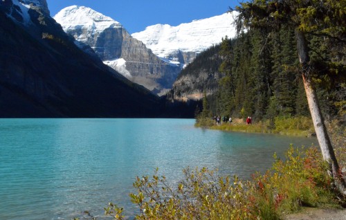
the 2 km stroll around the lake

0018f0018g0018h
looking back towards Fairmont Chateau, from where we first set eyes on the lake

0018i

Hugo walks up to Mirror Lake. Time is of the essence and I will not be able to walk fast enough – my steps are much smaller just for starters…

0018kh[photo by Hugo]

Finally it is time to move on. We head out to Moraine Lake. The road up is closed. There is a man sitting on the boom and cars are lined up. We wait. It soon becomes apparent that as cars drive out, others are allowed in. The queue is not long and thus our wait neither.
The 11km road, lined with the tallest trees allowing only glimpses of towering snow-capped peaks, winds its way up to the lake with cars parked along the road long before the end point. We decide that it is worth going all the way up as someone is bound to leave sooner or later. Sure enough, as we drive into the parking area, we replace the spot a visitor has vacated right before our eyes. By now we are ravenous so linger awhile to enjoy the lunch we packed in, surrounded now by those snow-capped mountains towering above us.

0018l0018m0018n

We will be looking for a rockpile. This is the quickest and easiest climb to achieve elevation to view the lake. The vision I have in my mind never equals reality, but in this case, the rockpile, right beside the lake, cannot be mistaken.

Moraine Lake, situated in the picturesque Valley of the Ten Peaks, is glacier fed and only half the size of Lake Louise. Melt water from the glacier brings with it rock flour or silt and it is the reflection off this that creates the spectacular colour.

0018o0018p0018q0018r0018rh
[photo by Hugo]0018s0018t0018v
we do the lakeside walk

0018w
the glacier feeding the lake

0018x

I am reluctant to leave once again, but the day is drawing to a close and we have one more stop before heading back to camp.

Johnston Canyon.

Much as the photos of the canyon are enticing, my fear of heights is turning me into a less than happy chappy at the thought of actually doing the walk. Fortunately for me, time is on my side which means the turning point is reached at the lower falls. I am sure Hugo is more than disappointed to have to turn around, but then he did spend an extra 2 hours at Lake Louise hiking to Mirror Lake while I waited for him down below; I think it is fair to call it quits.

0018y0018z
lower falls

0018z1

Tomorrow we hit the Icefields Parkway… and please may there be no ice!


a little rusty

[september 12th]

Remember one thing: we come from the southern tip of Africa, where the winter temperatures seldom dip below 8degC and where snow is the stuff of fairy tales… it is with this in mind that we head out with just a little more than trepidation. We are a little rusty; it has been some time since we have ventured far off our doorstep.

We could have headed straight up to Banff from Cranbrook, but we have this desire to peep in on the other side of the Rockies and so we set out back through Fernie towards Alberta. This is a good move, as we already know Fernie, and its stores, which makes it a little less daunting to stop for provisions, which we now have to do for ourselves; no more B&G to treat us. Okay then, it is only me that finds anything new daunting for reasons even I cannot explain to myself. It seems I have difficulty processing too much information thrown at me all at once, especially in noisy and bright conditions. It helps to talk myself through my actions, which doesn’t look good at all if I am on my own; so grateful to have Hugo at my side.

A mere one week prior to this day, Fernie was still baking under a summer sun; we return now, to a wonderland of snow-capped peaks. Excitement fills the chilly air; snow is a novelty for us!

00170017a0017b

Just around the corner, the countryside opens out into rolling agricultural plains, flanked by the Rockies to the west.
It is a good 200kms to Calgary. We settle back to enjoy the ride. I am determined not to think about negotiating the city until it is time.

And then, too soon, it is time!

Hugo is driving; that is enough for him to deal with as the traffic hurtles down at him on the wrong side of the road. His brain has yet to adjust to 60+ years of incorrect information. In South Africa, we drive on the left side of the road.
I am faced, yet again, with information hurtling down on my brain. I must remember to breathe!
We do have a GPS, but it doesn’t allow me to anticipate the next move, at least not visually, and that is when I remember google maps. YAY! I have an iPad too, with reception! Oh, how I love technology! Never before have I appreciated that little blue moving dot quite as much as right now. Once again, standstill traffic is a blessing, if one is in the correct lane! The little blue dot ensures that I can direct Hugo accordingly in very good time.

In the end, I really enjoyed the little navigation exercise.

Time to fuel up. Hugo has been watching and learning; this is not something we have to do for ourselves in South Africa. He manages like a pro. Back to the Rockies we go.

0017c

Calgary looms

0017d

breathing space enough to enjoy the art

0017f0017h0017e

0017g

everything is super large

I can hardly contain myself as we roll in closer and closer to those magnificent mountains dusted with icicles thicker than ever I have set eyes upon before. I didn’t know which way to turn as we sped past snapshots, window-framed, in every direction.

But I must concentrate. We will need to turn off at some point and everybody seems to be in a rush to get to wherever they are going.

And then it was gone; we flew under it long before our brains could catch up with the instructions. We needed a park pass, this I knew, but I hadn’t registered that we needed it as we entered the area. Easy to panic. What to do? Eventually, the little ducks all fell into their row up there in the grey matter, and I realised that we could buy our park pass at our campground; the gates we had sailed past, sans laissez-passer, were more as a convenience for those travellers that were speeding right through and out at the other end. Breathe.

It was with relief that finally, our exit came into sight. Bow Valley Parkway was a narrow winding road through luscious scenery at a very reduced speed.

We found our pre-booked campsite in good time and settled down for a good night’s rest.

Lakes are on the menu once the new day dawns.

0017i0017j0017k0017l0017m0017n0017o0017p0017q


Thought for the day:

“Our lives are a collection of stories – truths about who we are, what we believe, what we come from, how we struggle, and how we are strong. When we can let go of what people think, and own our story, we gain access to our worthiness – the feeling that we are enough just as we are, and that we are worthy of love and belonging. If we spend a lifetime trying to distance ourselves from the parts of our lives that don’t fit with who we think we’re supposed to be, we stand outside of our story and have to hustle for our worthiness by constantly performing, perfecting, pleasing, and proving. Our sense of worthiness lives inside of our story. It’s time to walk into our experiences and to start living and loving with our whole hearts.”
~ Brené Brown


heavy-hearted

0016k

It was only when Galen mentioned that it was September 11th that we realised what day it was and why many flags were flying half-mast. Technology had brought the horror of events as they unfolded that day, right into our living rooms even in South Africa, thousands of miles away. It’s not that similar events around the rest of the world are less horrific, but this day we watched them live; the feelings of helplessness are indescribable!

Even so, life moves on… and our stomachs were growling.

Time for brunch.

It’s the small things in life, you see, that make the big things bearable.

…and this meal had our taste buds in for a treat par excellence!

We were on the road again…

…back across the border; B&G had a plane to catch. It was a late night plane, so we stopped off at the campgrounds where H&I would spend the night. There were sites a plenty available under the massive trees in the Moyie Lake Provincial Park, so we set up camp, took a stroll down to the water, and then headed out again with another quick stop for a flight of a different kind.

0016o

0016r

It was with a heavy heart that finally there was no denying that the time had come to head for the airport just north of Cranbrook. H&I had to continue our trip on our own now, into the unknown, just the 2 of us, on the right side of the road. We would miss those 2, their company, the excitement of a catch on the fly, the trouble they took over meals both in and out, and their navigation!

0016s

May your days in the office be stimulating!

Banff, here we come, ready or not…


trout bums

[September 9th]

On the road again we head north once more, but not back into Canada yet; B&G are taking us a little off the beaten track again for the last 2 days of fishing before they have to return to their offices.

Along the way, we stop to stock up on provisions and to enjoy brunch at Jimmy John’s Gourmet Sandwiches. America is not complete without another stop at Starbucks for none other than the super sweet pumpkin spice latte (you have to try it, they say!) – Thanksgiving is coming up.

B&G navigate their way comfortably through the Montana countryside, and before too long we turn off in search of Trout Bums where we will be spending 2 nights in a cabin.
It is a surprise it turns out because said cabin, named Trouthaus, glows with warmth and solid luxury.
I love camping more than anything else in this world, but I have to admit there does come a time when a bath to soak in and a toilet for just the 4 of us, is a very welcome sight indeed!

0015o0015p

Hugo is the lucky recipient of a fishing licence for this area, a Father’s Day gift, so while they head down to the river at the bottom of the property, I partake of the hot water on tap. My head of hair most especially enjoys being submerged under water for a good long soak, after which I stretch out on the deck surrounded by the bliss of the forest and the birds that frequent it.

0015pa

When there is no longer a single ray of light left to squeeze out of the day, the 3 fishermen return; Hugo lights the fire, I load the washing machine (which we were thrilled to find, as H&I head straight on to our next 2 weeks of camping after this) and B&G busy themselves in the kitchen.
Once again we are served a scrumptious meal which we devour in front of the crackling fire before retiring to grandma’s feather beds for the night.

0015q

From the cabin, the track runs all along Rock Creek, so into our trusty auto we bundle to find a spot to fish. There are spots by the dozen but everybody has beaten us to the best already. After a good couple of kilometres, we emerge into the sunlight and finally a great spot with no takers.

0015v0015w0015x

When hunger beckons we head back to find a suitable place to prepare lunch. While the pot boils, the men cast a few more lines… and no, the bush has not returned us to our roots, nor have we forgotten our table manners; we simply forgot to pack eating utensils.

And so, all good things have to come to an end…

0015za

…but there is always the next leg with fresh ones just waiting to be discovered…


Thought for the day:
“Whatever we perceive in the world around us tends to reflect who we are and what we care about most deeply, as in the old saying, ‘When a thief sees a saint, all he sees are his pockets.'”
~ Sufi quote [Centre for Applied Jungian Studies]